- Log in to post comments
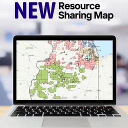
RAILS is excited to announce the launch of its new Resource Sharing Map, a powerful tool designed to help libraries explore, analyze, and advocate for libraries across Illinois. Built on the advanced ArcGIS software platform, this updated map is now publicly available and offers more features and flexibility than ever before.
The new map allows users to search and filter by features like consortia buildings, public library service areas, system service areas, Illinois counties, and more. Whether viewing the map on a statewide scale or narrowing the focus to specific details, users can access a comprehensive and customizable view of Illinois' library landscape.
This digital map replaces the previous printed version, which had not been updated since 2019. With its new digital format, RAILS will be able to update the map more frequently, ensuring users always have access to the latest data. Key features include the ability to filter by system boundaries, public library boundaries, consortia, and other relevant factors, creating a more dynamic user experience.
To learn more about the new map and its capabilities, join the RAILS Member Update on Wednesday, September 10, where RAILS Data Analysis Manager Grant Halter will provide an overview of the map. Additionally, Halter will present the new map at an upcoming RAILS Showcase on Wednesday, September 24, 2–3 p.m.
Questions? Contact RAILS Data Analysis Manager Grant Halter, 630.734.5144.